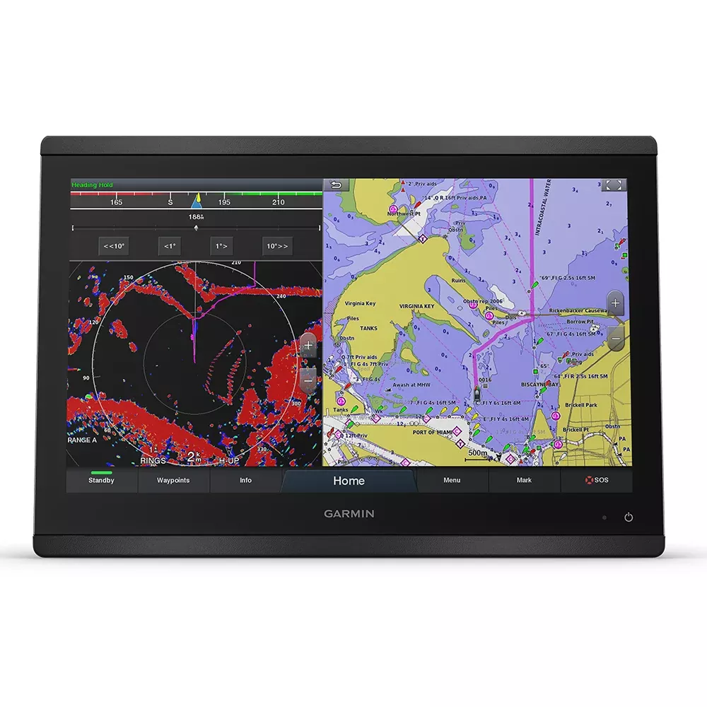
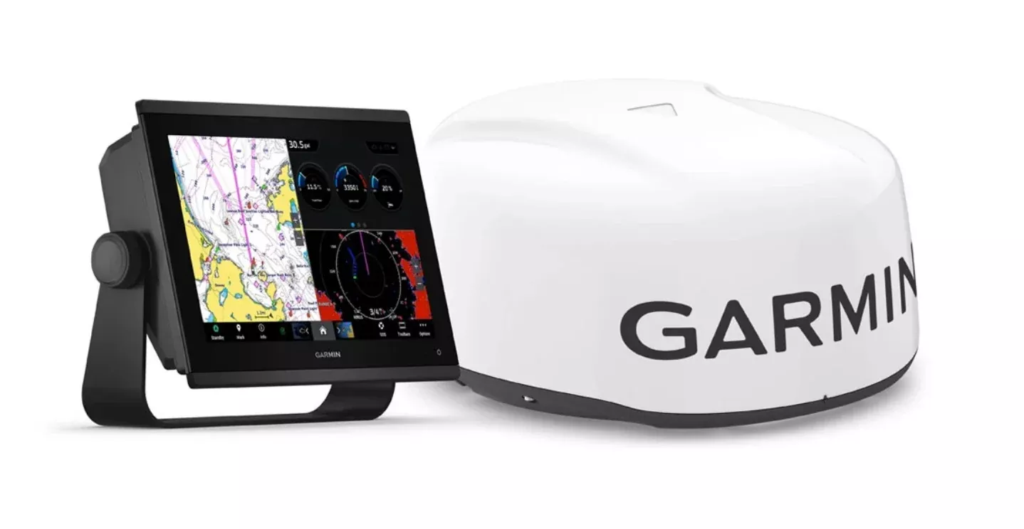
The Garmin GPSMAP 8416 is the 16-inch glass-helm chartplotter for serious cruisers, sportfishermen, and sailing yachts. Full HD IPS touchscreen (wide viewing angles, sunlight readable, polarized-sunglass compatible), Garmin Marine Network + NMEA 2000 connectivity for full multi-display electronics integration, built-in Wi-Fi / Bluetooth / ANT for ActiveCaptain app pairing and wireless accessory connectivity, SmartMode one-touch station controls, SailAssist for sail trim and prerace guidance, OneHelm third-party device control, expandable charts (BlueChart g3 / BlueChart g3 Vision with integrated Navionics data), Auto Guidance route suggestions, USB touch output for use as a Windows / Mac monitor, edge-to-edge flush mountable for the modern glass-helm look. Worldwide basemap included.
The Garmin GPSMAP 8416 is the top-tier 16-inch chartplotter from the GPSMAP 8400 series – the flagship Garmin glass-helm display platform for serious offshore cruisers, sportfish boats, and sailing yachts that want maximum screen real estate, full HD resolution, and the complete Garmin Marine Network feature stack in one display. It’s the largest screen Garmin offers in the GPSMAP 8400 form factor, and the right call for boats where the helm has the room and the operator wants the most chart and data on screen at once.
Full HD IPS touchscreen with marine viewing characteristics. The 16-inch display is full HD (1920 x 1080) with In-Plane Switching (IPS) panel technology – the same panel technology used in premium computer monitors and high-end tablets. IPS means wide viewing angles (the screen looks the same from any angle, not just dead-center), accurate color reproduction (chart colors look the way the chart designers intended), and meaningfully better contrast than older TN panels. The display is engineered for marine use: high brightness for sunlight readability (the screen stays visible in direct overhead sun), polarized-sunglass compatibility (the screen doesn’t go dark when viewed through polarized fishing glasses), and a sealed housing that handles salt spray and humidity without internal condensation issues.
Glass-helm flush mounting. The display works for edge-to-edge flat mounting (multiple displays side-by-side with bezels touching – the modern glass cockpit look) or traditional flush mounting in a single helm pod. You’ll find the minimal bezel design and standard mounting pattern make multi-display configurations clean. Mounting hardware included.
Garmin Marine Network and NMEA 2000 connectivity. The 8416 sits at the center of a complete Garmin marine electronics suite. The Garmin Marine Network (Garmin’s proprietary high-bandwidth Ethernet protocol) connects radar, sonar, autopilots, cameras, additional displays, and forward-looking sonar units – all sharing data and all controllable from any networked display. NMEA 2000 is the standards-based marine bus that connects engine data, fuel sensors, environmental sensors, AIS receivers, and the broader marine sensor ecosystem. The combination means the 8416 can display data from any sensor on the boat and control any compatible component from the touchscreen.
OneHelm third-party device control. OneHelm is the Garmin feature that brings third-party marine system control onto the chartplotter screen. Digital switching panels, electric stabilization systems, lighting control, climate control, entertainment systems – if the third-party manufacturer has a OneHelm integration, that system’s controls appear on the 8416 screen as a dedicated tab. The advantage: one screen replaces what would otherwise be 4-6 separate proprietary controllers scattered around the helm.
Built-in Wi-Fi, Bluetooth, and ANT. The 8416 has all three wireless protocols built in. Wi-Fi pairs the chartplotter to the free ActiveCaptain mobile app for chart updates over-the-air, smart notifications routed from the phone to the chartplotter, OneChart purchases pushed to the chartplotter from the app, and Garmin Quickdraw community contour data sharing. Bluetooth pairs media-streaming audio. ANT (Garmin’s proprietary low-power wireless protocol) connects the quatix marine watch (so the watch can display chartplotter data on the operator’s wrist), the gWind Wireless 2 transducer (wireless wind data, no cable run up the mast), and Garmin wireless remote controls. All three radios are integrated – no separate Wi-Fi or Bluetooth dongle required.
SmartMode station controls. SmartMode is Garmin’s preset configuration system. Each “station” is a saved screen configuration optimized for a specific use case: docking station (close-in chart + bow camera + engine data), cruising station (full chart + AIS overlay + waypoint manager), fishing station (chart + sonar + temperature gauges + tide / current data), sailing station (chart + wind rose + SailAssist data + laylines). One touch on the SmartMode tab switches the entire screen layout to the preset, no manual reconfiguration. For high-stress situations like docking in a tight slip, you don’t have time to manually rebuild the screen layout – the one-touch preset is meaningfully faster.
SailAssist for sail racers and cruisers. SailAssist is Garmin’s sailing-specific feature suite. Laylines (showing the optimal tacking angles to a windward mark), enhanced wind rose (true and apparent wind angle, true and apparent wind speed visualized graphically), heading vs. course-over-ground lines (showing leeway at a glance), true wind data computed from boat speed and apparent wind, tide / current / time slider for race start strategy, and prerace guidance with countdown timers and start-line bias indicators. For sail racing, it’s the meaningful advantage that lets a chartplotter substitute for purpose-built racing instruments. For cruising sailors, the same data improves passage planning.
BlueChart g3 / g3 Vision charts (with integrated Navionics data). The 8416 ships with the Garmin worldwide basemap. For detailed coastal navigation, add BlueChart g3 (standard detail) or BlueChart g3 Vision (premium detail with Auto Guidance, 3D views, satellite imagery overlay, and panoramic photo views) via SD card. Garmin acquired Navionics in 2017, and the latest BlueChart g3 charts integrate Navionics chart data – so you’ve got the deep chart data Navionics is known for, in Garmin’s native chart format. Charts are sold separately by region.
Auto Guidance route suggestions. Auto Guidance uses the chart’s depth data, the boat’s draft and beam dimensions, and known navigation hazards to suggest a safe route to a destination. The operator inputs the destination, the chartplotter computes a route that avoids shallow water, charted obstructions, and rocks. The suggested route is a starting point that doesn’t replace operator judgment – review and adjust as needed – but it saves significant manual route-building time on long passages.
ActiveCaptain app integration. ActiveCaptain is Garmin’s free mobile app (iOS and Android) that pairs with the 8416 over Wi-Fi. Features: OneChart chart purchases (buy a chart on the phone, the chart pushes to the 8416 over Wi-Fi), Garmin Quickdraw community data (crowd-sourced contour mapping for unmapped lakes), smart notifications (incoming text messages and calls from the paired phone display on the chartplotter so the helmsman doesn’t have to look away), waypoint and route sharing between phone and chartplotter, and over-the-air software updates pushed to the chartplotter.
USB touch output for monitor use. The 8416 has a standard USB output that lets it function as a touchscreen monitor for a Windows or Mac computer. Plug a laptop into the 8416 via USB and the laptop screen displays on the 8416 with full touch input – useful for running PC-based marine software (electronic logbooks, weather routing applications) or using the 8416 as a high-resolution sunlight-readable display for laptop work at the helm.
Optional GRID 20 remote control. The GRID 20 (sold separately) is a 360-degree joystick with rotary knob and push-button select – a hard-button input device for the chartplotter that lets the operator control the screen from a remote location (a flybridge or cockpit position away from the helm) without reaching the touchscreen. Useful in rough conditions where touchscreen accuracy suffers, or for an operator who prefers tactile controls over touch.
What’s in the box. The 8416 chartplotter, flush mount kit, NMEA 2000 drop cable, power / data cable, USB monitor adapter cable, mounting hardware, basic install guide. Required separately: BlueChart g3 charts for detailed coastal navigation, GPS antenna (the 8416 doesn’t have an internal GPS – typical install uses the GA 38 or GA 38 with the chartplotter), and any additional Marine Network or NMEA 2000 components.
Two-year limited warranty. Standard Garmin warranty terms apply. This is a heavy-freight item that may require freight shipping rather than parcel.