Discover Superior Fish-Finding Power with Advanced Sonar Imaging
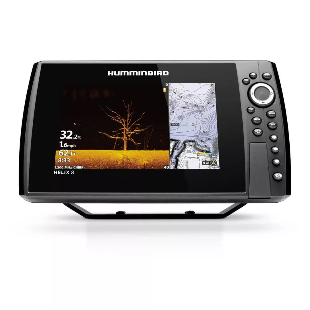
Imagine gliding across the water, pinpointing fish and structure with crystal-clear detail right from your boat’s helm. The HELIX 8 CHIRP MEGA DI GPS G4N delivers that edge, combining cutting-edge sonar technologies with intuitive navigation to transform your angling adventures. Anglers swear by its ability to reveal what’s lurking below, from subtle bottom contours to schools of game fish, making every trip more productive and exciting.
Crafted for serious boaters and tournament pros, this unit stands out with its high-resolution imaging that outperforms traditional sonar. Whether you’re chasing bass in shallow bays or walleye in deeper waters, it provides the real-time insights needed to outsmart your target species.
Master the Depths: MEGA Down Imaging and Dual Spectrum CHIRP
At the heart of this fish finder lies MEGA Down Imaging, offering three times the detail of standard down imaging. Coverage extends up to 125 feet beneath your vessel, unveiling razor-sharp photos of the underwater world—fish hovering near drop-offs, submerged timber, and rocky ledges all come into focus like never before.
Live Action Viewing: MEGA Live brings dynamic motion to your screen, letting you watch fish react as your lure approaches.
CHIRP Excellence: Dual Spectrum CHIRP sonar sweeps a broad frequency range, producing precise fish arches, enhanced structure definition, and accurate bottom composition. Switch between Wide Mode for broad scans or Narrow Mode for hyper-detailed targeting.
Powered by a low-Q CHIRP transducer, these tools minimize clutter and maximize separation, giving you confidence before dropping a line.
Effortless Navigation with Built-In GPS and Basemaps
Never lose your spot again. Internal GPS tracks your position with pinpoint accuracy, supporting up to 2,750 waypoints for marking honey holes and return trips. The Humminbird Basemap covers over 10,000 freshwater lakes and U.S. coastal areas, highlighting buoys, hazards, marinas, contours, and depth markers.
Upgrade seamlessly with premium charts like LakeMaster for shaded contours and depth highlights, or Navionics for even more detail. It’s all about building custom maps that match your local waters perfectly.
Seamless Connectivity for a Unified Boating Experience
Build a pro-level system with Ethernet, Bluetooth, Wi-Fi, and NMEA 2000 integration. Link up with Minn Kota trolling motors, Cannon downriggers, and other One-Boat Network gear for hands-free control and synchronized features.
AutoChart Live: Map contours, hardness, and vegetation in real-time—eight hours of onboard storage, expandable via Micro SD.
Wireless Freedom: Update software via app, control anchors remotely, and view phone notifications without leaving the screen.
Expand Your Setup: Add radar, AIS, or 360 Imaging for all-around awareness.
User-Friendly 8-Inch Display and Rugged Build
The vibrant 8-inch LCD (1024 x 600 pixels) shines bright even under direct sun, with keypad controls that feel natural in rough conditions. Fully waterproof and compact (12″ x 7″ x 4.13″), it mounts easily on any console. Soft keys and customizable menus keep operations quick and glove-friendly.
Real-World Benefits for Everyday Anglers
Boat owners report landing more fish faster, thanks to the unit’s ability to differentiate species by behavior and habitat. Tournament anglers leverage its networking for spot-on trolling paths, while casual fishers enjoy hassle-free mapping of new lakes. Durability meets innovation, backed by a solid two-year warranty for peace of mind on the water.
Frequently Asked Questions
What makes MEGA Down Imaging better than standard sonar?
MEGA Down Imaging provides up to 3X more detail and covers depths to 125 feet, showing photo-like images of fish and structure for superior target identification.