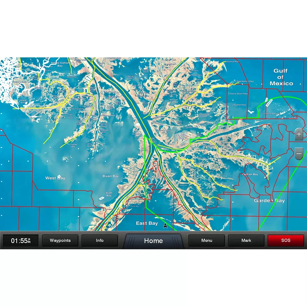
Navigate Louisiana’s intricate coastal waters with confidence using this specialized mapping card. Designed for serious mariners, it layers high-resolution aerial imagery over the entire state, highlighting local waterway names, prominent land features, clearly outlined Wildlife Management Areas, and Offshore Lease Areas. What truly elevates it is the expert input from Standard Mapping’s seasoned pro staff, delivering insights that go beyond standard charts to reveal hidden gems for fishing and exploration.
Unmatched Detail for Coastal Adventures
Louisiana’s coastline is a maze of bays, marshes, and channels, where precision can make the difference between a successful outing and a frustrating detour. This card equips your Garmin chartplotter with vivid, up-to-date visuals that capture the essence of the region. From the shallow inlets perfect for kayak fishing to the deeper offshore zones teeming with redfish and speckled trout, every detail is rendered to help you plan routes that maximize safety and opportunity.
Standout Features Tailored for Louisiana Waters
Oyster Leases Outlined in White: Spot productive lease areas instantly, ideal for targeting oysters or the predators that hunt them. This visual cue saves hours of scouting and boosts your harvest potential.
Artificial Reefs Marked with White Dots: Locate these fish-attracting structures effortlessly. Whether you’re dropping lines for snapper or bottom fishing for grouper, these markers guide you straight to the action.
Precise State and Federal Offshore Boundaries: Know exactly when you transition between jurisdictions. This is crucial for complying with regulations, avoiding fines, and accessing the right species in permitted zones.
Comprehensive Statewide Coverage: Seamless aerial overlays span Louisiana One, blending satellite-like clarity with nautical essentials for both inland bays and open Gulf waters.
Why This Mapping Card Empowers Serious Boaters
Imagine heading out at dawn, your chartplotter lighting up with local knowledge that feels like having a lifelong bayou guide on board. Anglers rave about how the oyster lease outlines reveal prime spots during peak seasons, while reef markers turn average trips into trophy hauls. Offshore boaters appreciate the boundary lines, especially during busy tournaments or when chasing pelagic species. It’s not just data—it’s a competitive edge crafted by pros who fish these waters daily.
For safety, the high-res imagery helps dodge shoals and wrecks that generic maps might gloss over. During storm season, quick visualization of WMAs and leases aids in strategic anchoring or evacuation planning. Insert the card into your compatible Garmin device, and it integrates seamlessly, updating your display without fuss.
Pro Tips for Maximizing Your Mapping Experience
Pair it with sonar overlays to correlate reef dots with live fish arches for pinpoint accuracy.
Use the local feature names to communicate exact positions with fellow captains via VHF.
Zoom into lease boundaries before tides change—currents around oysters can shift hotspots dramatically.
Combine with weather apps on your plotter to time offshore runs when federal boundaries align with favorable winds.
Frequently Asked Questions
What devices is this Louisiana mapping card compatible with?
It works with a wide range of Garmin chartplotters that support microSD or SD cards, providing instant access to detailed coastal data.