Why Choose the Garmin GPSMAP 1022xsv for Your Vessel?
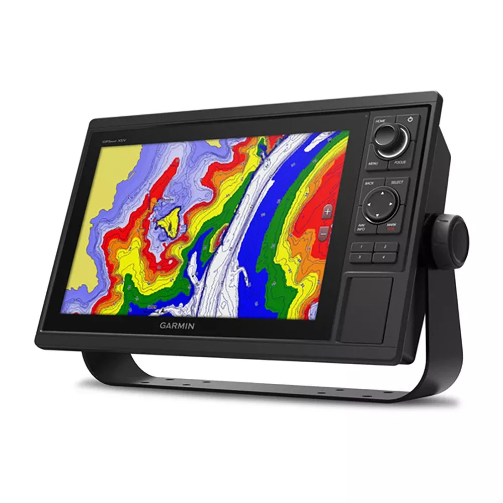
Imagine navigating open waters with crystal-clear visuals and pinpoint accuracy, all from a rugged 10-inch touchscreen that responds effortlessly to your commands. The GPSMAP 1022xsv stands out as a powerhouse chartplotter and sonar combo, designed for boaters who demand reliability without the bulk. Its keyed interface, complete with programmable hotkeys and a versatile control knob, lets you switch between charts, sonar returns, and radar overlays in seconds—perfect for those high-stakes moments on the water.
Whether you’re chasing trophy fish in shallow bays or plotting a coastal cruise, this unit delivers fluid 10 Hz GPS updates, ensuring your position refreshes 10 times per second for smoother tracking and easier waypoint drops. No more guessing games; just precise heading and speed data that keeps you on course.
Advanced Sonar and Navigation That Sees Everything
Dive deep into fishfinding with built-in 1 kW CHIRP traditional sonar, paired with CHIRP ClearVü for down-facing clarity and CHIRP SideVü for wide-angle side scans. Add Panoptix live sonar support, and you’ve got real-time views of fish and structure moving around your boat—all without buying a transducer upfront. Network it with other Garmin devices to share sonar data fleet-wide, overlaying radar or GPS speed for a tactical edge.
Mapping gets personal with Quickdraw Contours, letting you generate 1-foot HD contour maps on the fly. Crowdsource intel from the Quickdraw Community or keep your secret spots private. Dual SD card slots mean endless storage for BlueChart or LakeVü upgrades, complete with Auto Guidance paths that simplify route planning while respecting no-go zones.
Seamless Networking and Smart Connectivity
Connect the dots across your boat’s electronics with full Garmin Marine Network support—share charts, user data, radar images, IP cameras, and sonar across multiple screens. NMEA 2000 and 0183 compatibility integrates effortlessly with autopilots, AIS, VHF radios, weather stations, and FUSION audio systems.
Built-in ANT+ pairs with wearables like the quatix watch or gWind transducers for wireless wind data. Wi-Fi unlocks the ActiveCaptain app, turning your smartphone into a command center: plan routes, sync charts, get software alerts, and receive smart notifications without leaving the helm.
Tailored for Anglers and Sailors Alike
For competitive sailors, SailAssist shines with pre-race timers, virtual start lines, laylines, and synchronized race clocks across networked units. Track true/apparent wind, set/drift, and enhanced wind roses to maximize your upwind performance.
Anglers appreciate sonar history rewind, bottom lock, water temp graphs, and recording for post-trip analysis. Dropping 5,000 waypoints? Tracks up to 50,000 points? Covered. Import GPX files from other devices to hit the water running.
Robust Build and Performance Specs
Feature
Details
Dimensions
12.5″ x 7.3″ x 2.7″ (318 x 185 x 69 mm)
Display Size
8.8″ x 4.9″ diagonal (224 x 125 mm)
Resolution
1024 x 600 pixels
Waterproof Rating
IPX7
Power Draw
Max 32.4 W at 10 VDC
Waypoints / Routes / Tracks
5,000 / 100 / 50,000 points (50 saved)
Sonar Depth
Up to 5,000 ft (conditions dependent)
Network Ports
2 Garmin Marine Network, 1 NMEA 2000
Mount it bail-style for quick removal or flush for a sleek console. Internal antenna with external NMEA 2000 option ensures top signal strength.
Everything You Need to Get Started
GPSMAP 1022xsv chartplotter unit
Power and data cable
NMEA 2000 T-connector and 2m drop cable
8-pin to 12-pin transducer adapter
Bail mount kit with knobs
Flush mount kit with gasket
Protective cover and trim snap covers
Full documentation
Pro Tips for Maximizing Your GPSMAP 1022xsv
Customize SmartMode presets for split-screen views tailored to trolling, racing, or cruising. Pair with a high-power transducer for deeper scans, and use ActiveCaptain to pre-load community contours before heading out. For multi-boat setups, designate one unit as the sonar hub to minimize wiring clutter.